Services
Precision Agriculture
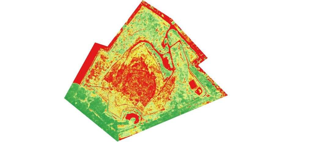
Situation of agricultural parcels and In field agronomic trials.
Forestry – Environment
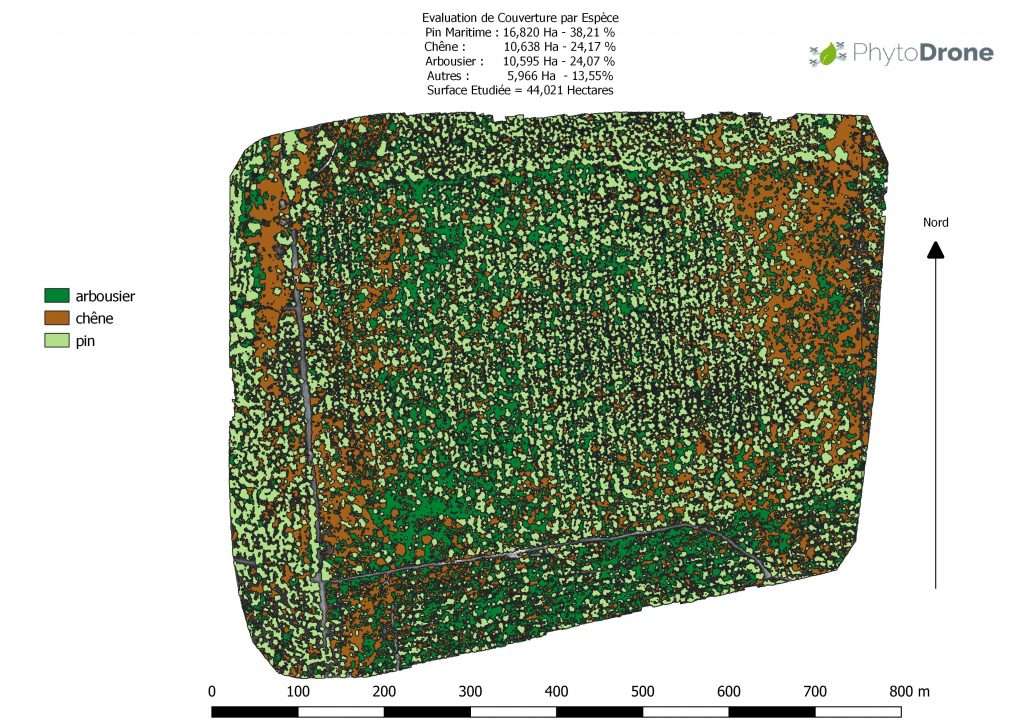
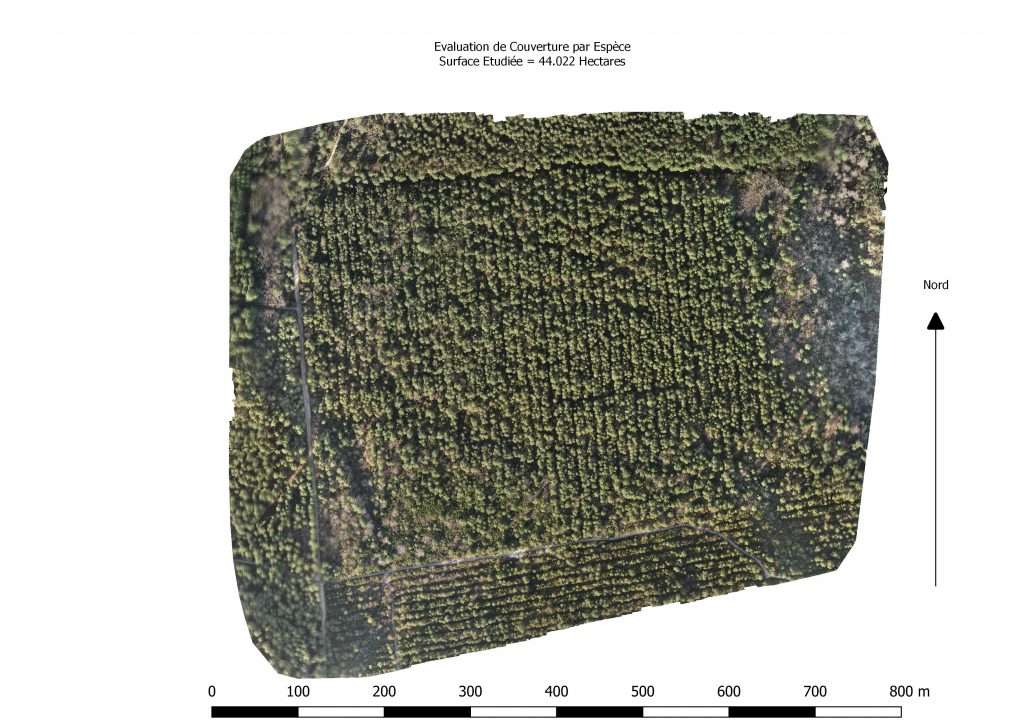
Forests :
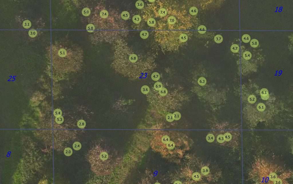
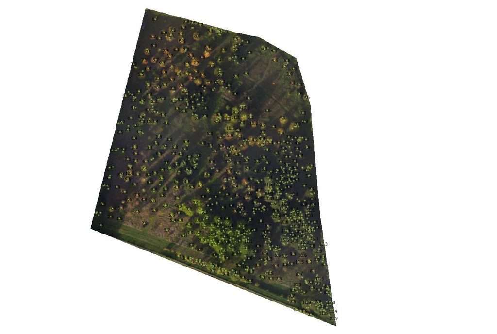
Trees counting with or without missing
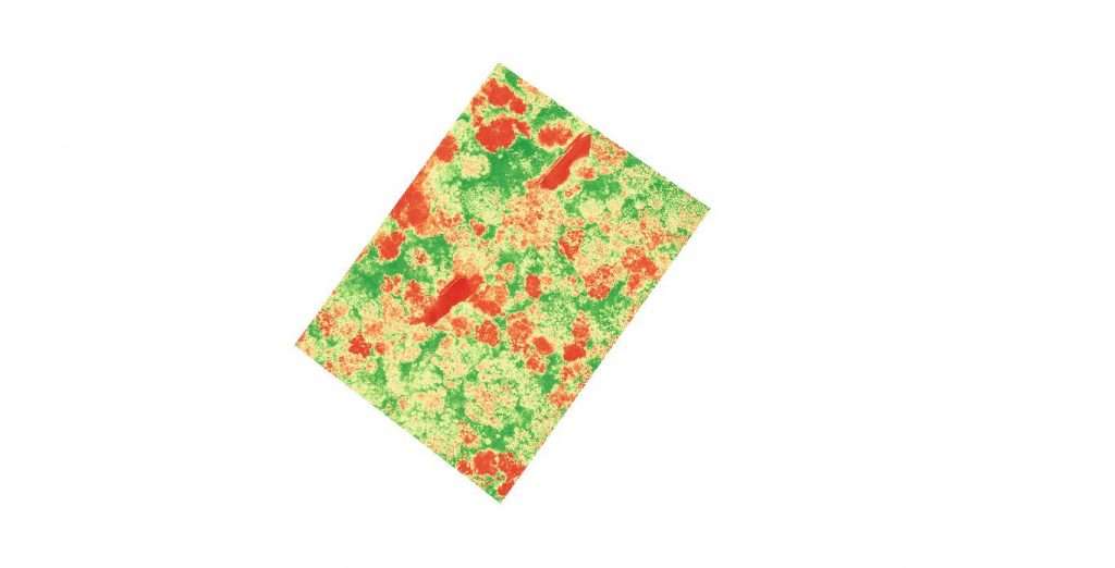
Vegetal Indexes : vigor sensing, sick trees
Height measurement of canopy or isolated trees
Environment :
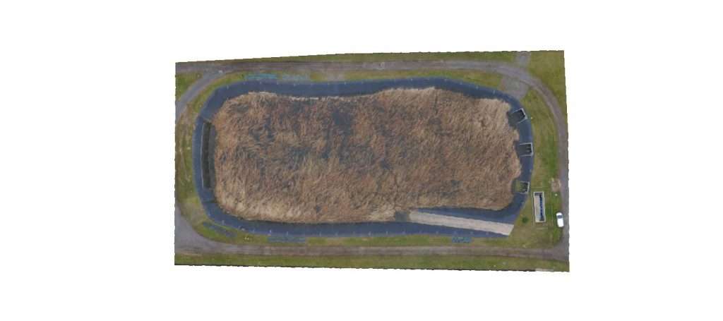
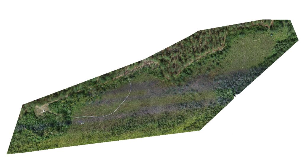
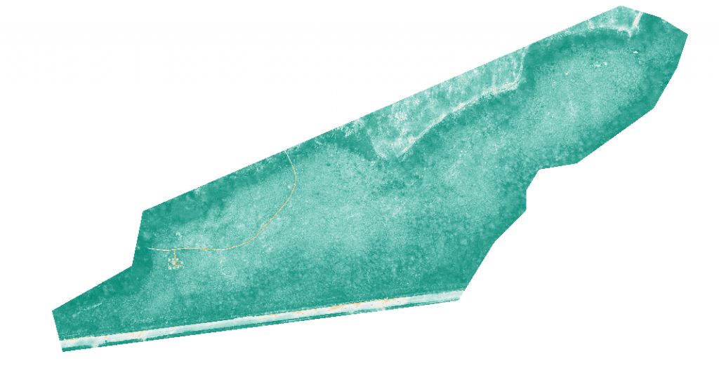
Foreshore follow-up, seaweeds population evaluation, vegetal cover measurement of waste and industrial sites …
Others
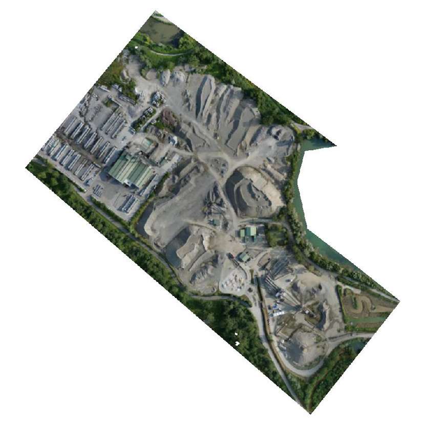
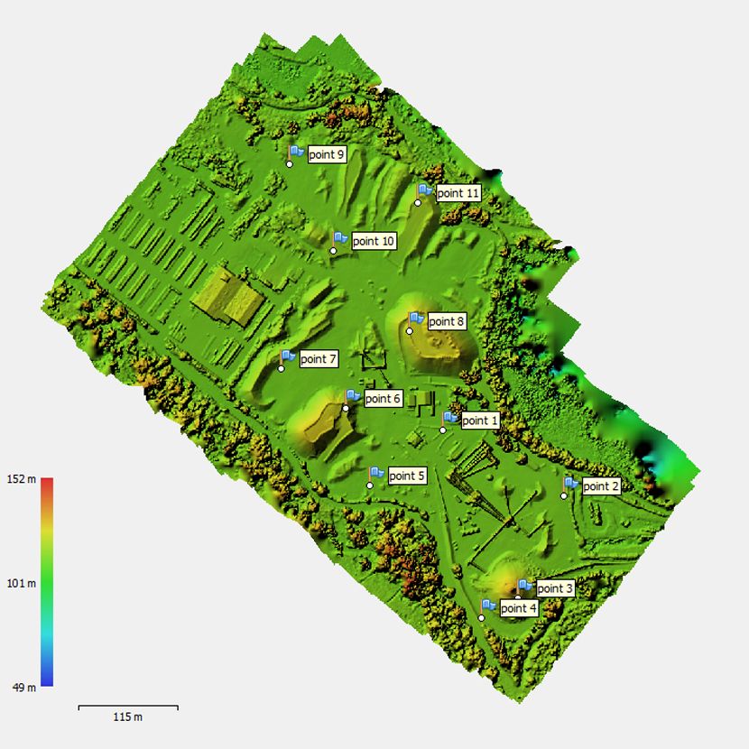
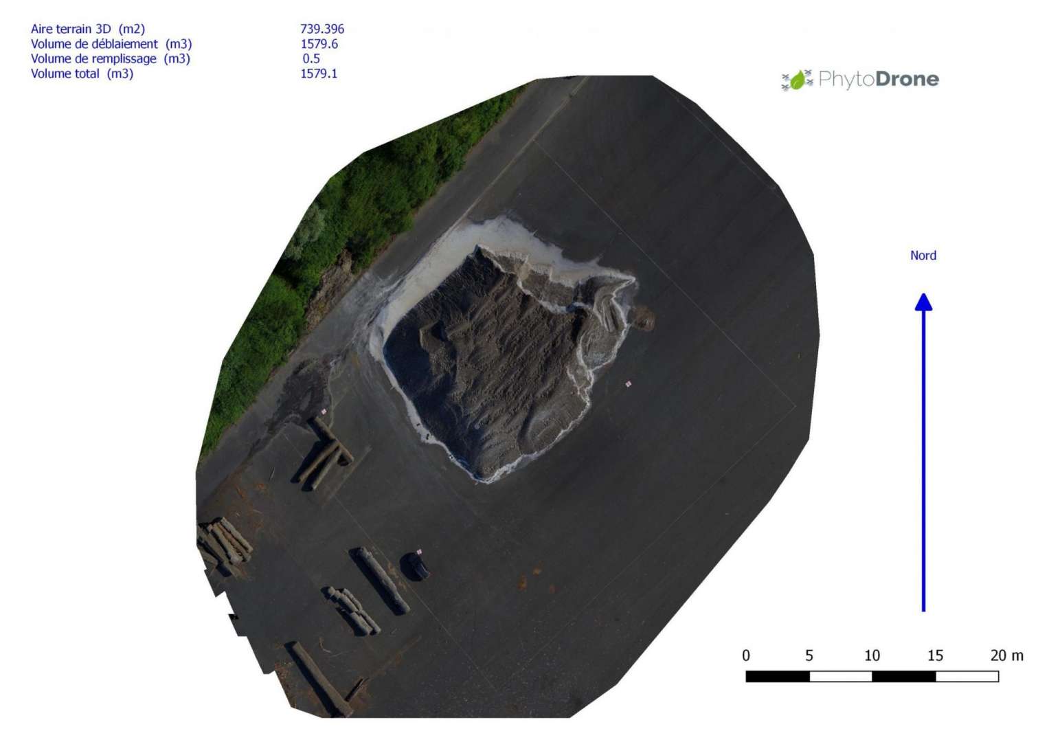
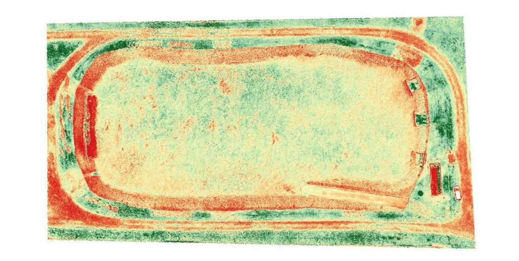
Stones Pits (Volume and situation reports), Insurances (Wildfowl damages, Sinisters …) …
Precision Agriculture
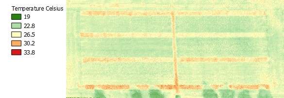
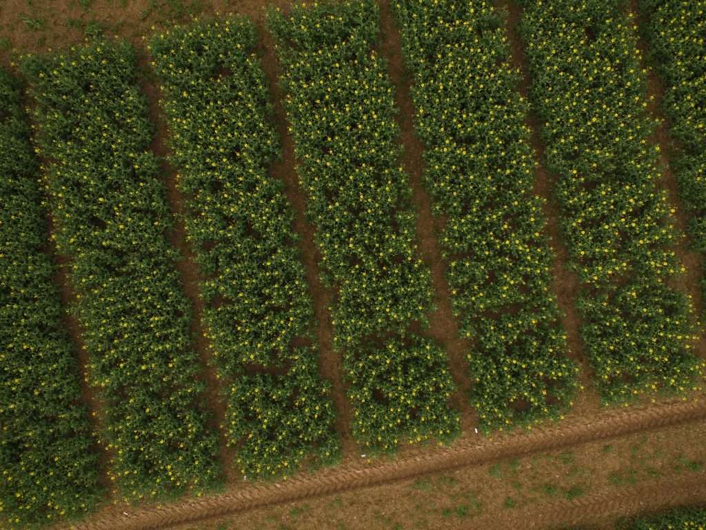
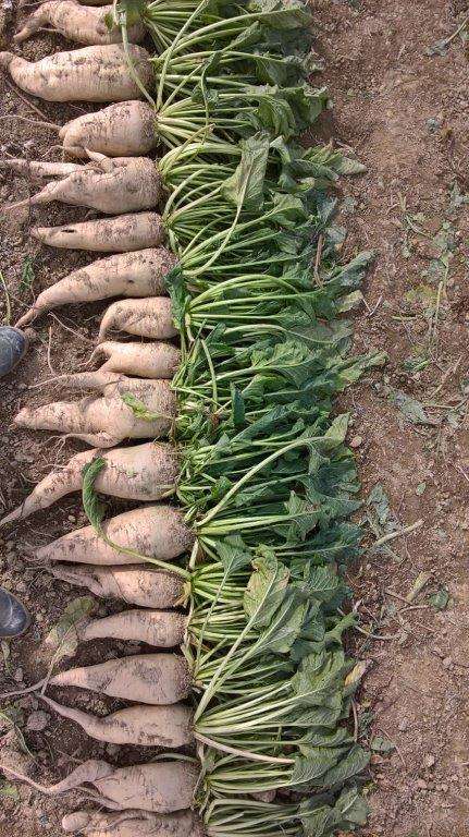
Remote sensing and data processing (photogrammetry – vegetal indexes (NDVI…)) on crops (wheat, barley, rapeseeds, maize, sunflower, vineyards and orchards …).
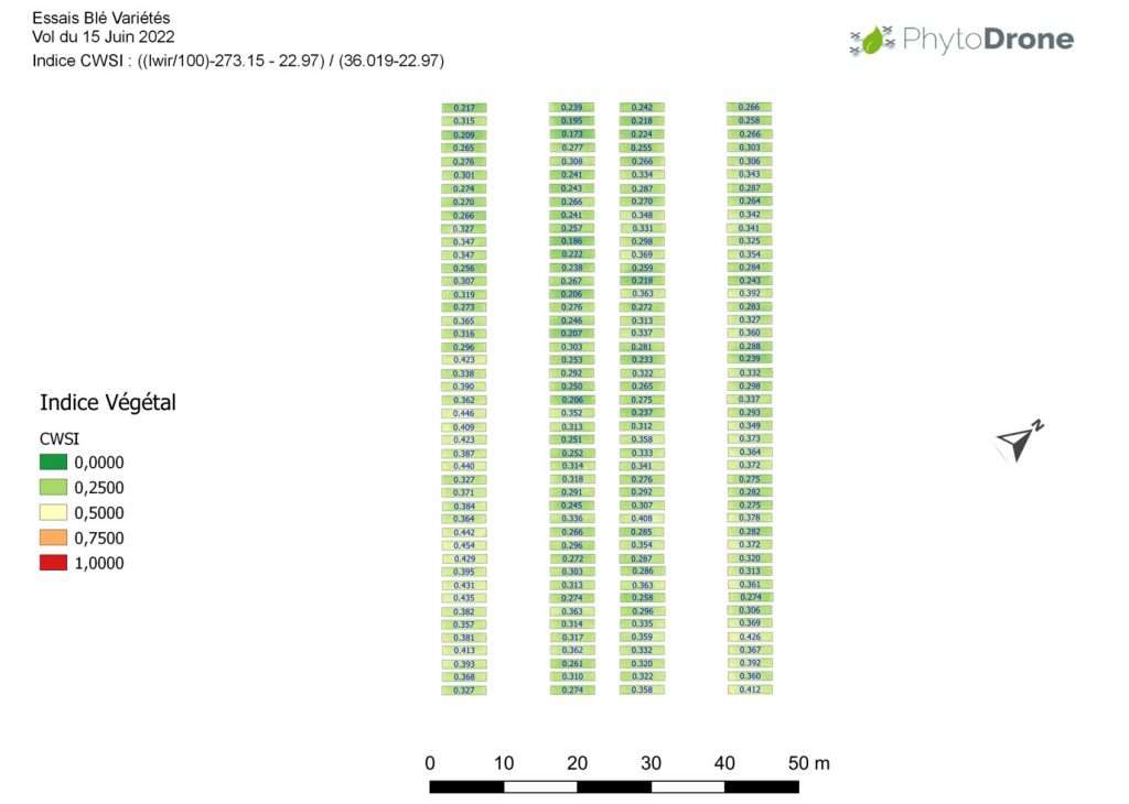
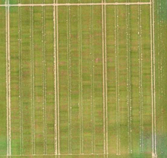
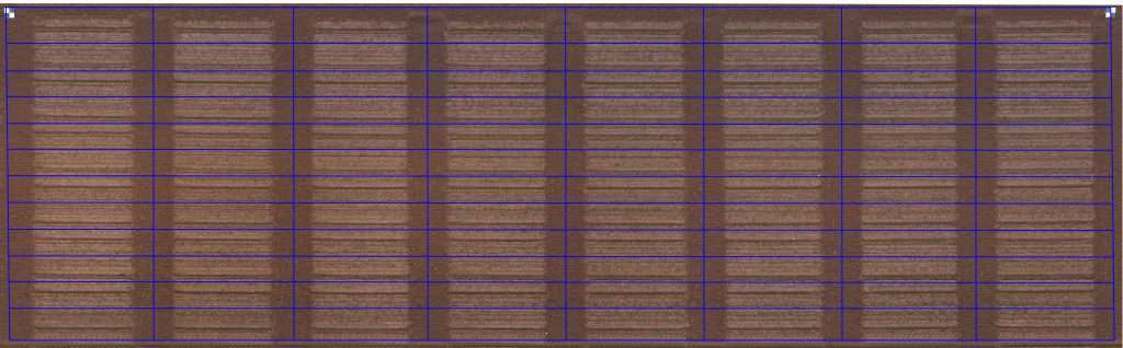
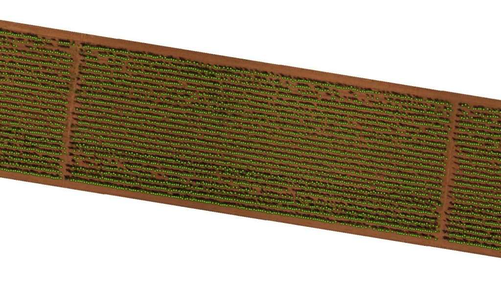
Experimentation – Phenotyping :
– Flights with multi-rotors at a low altitude with a RGB sensor and/or a Multi-Spectral sensor to get an accurate resolution (in millimeters) of micro-plots and allow and accurate and reliable phenotyping process.
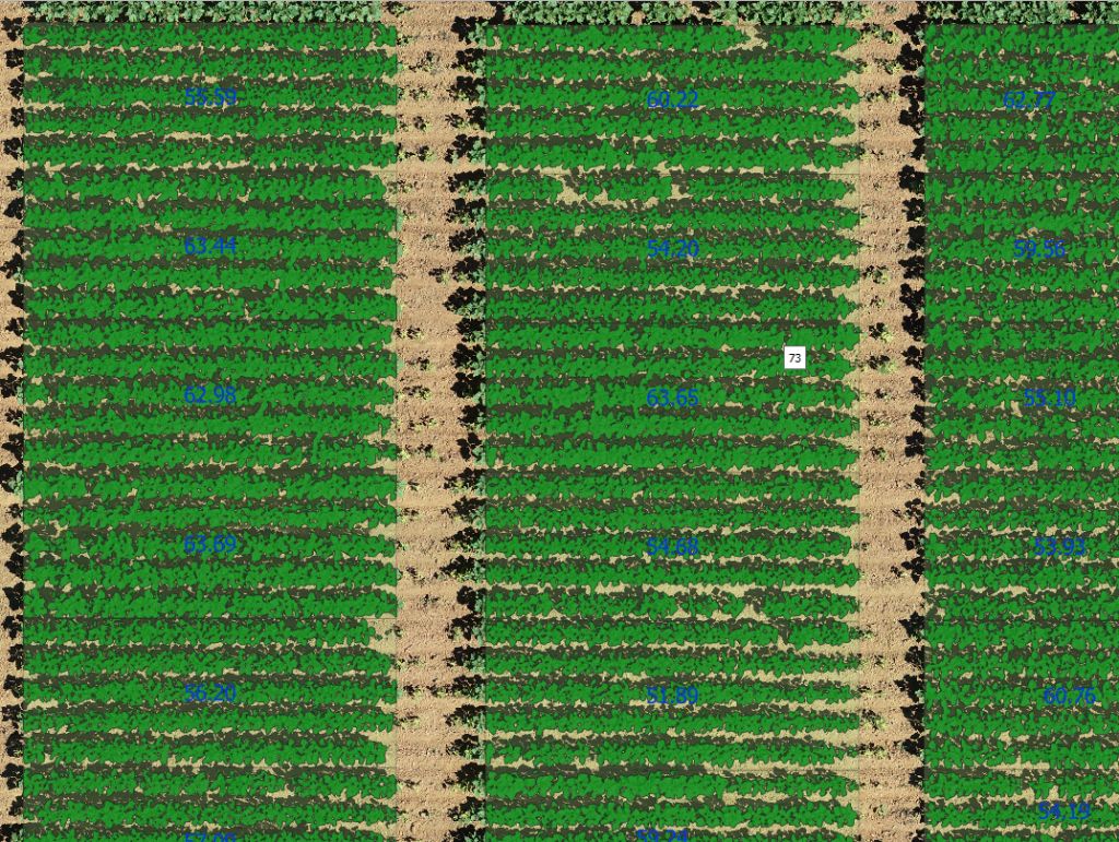
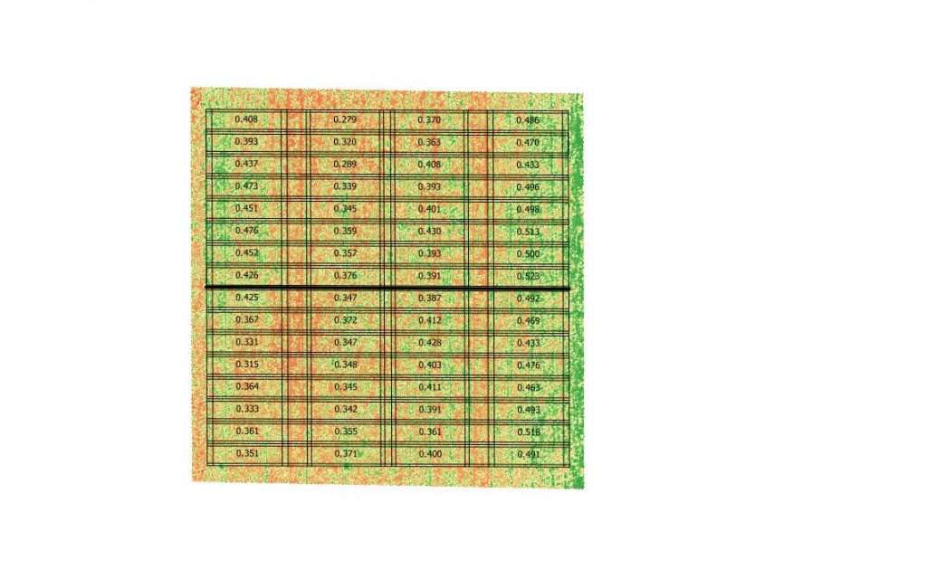
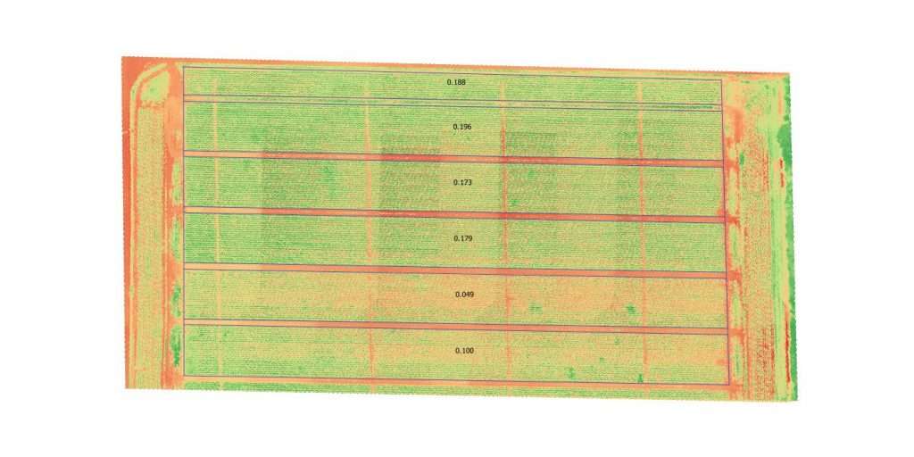
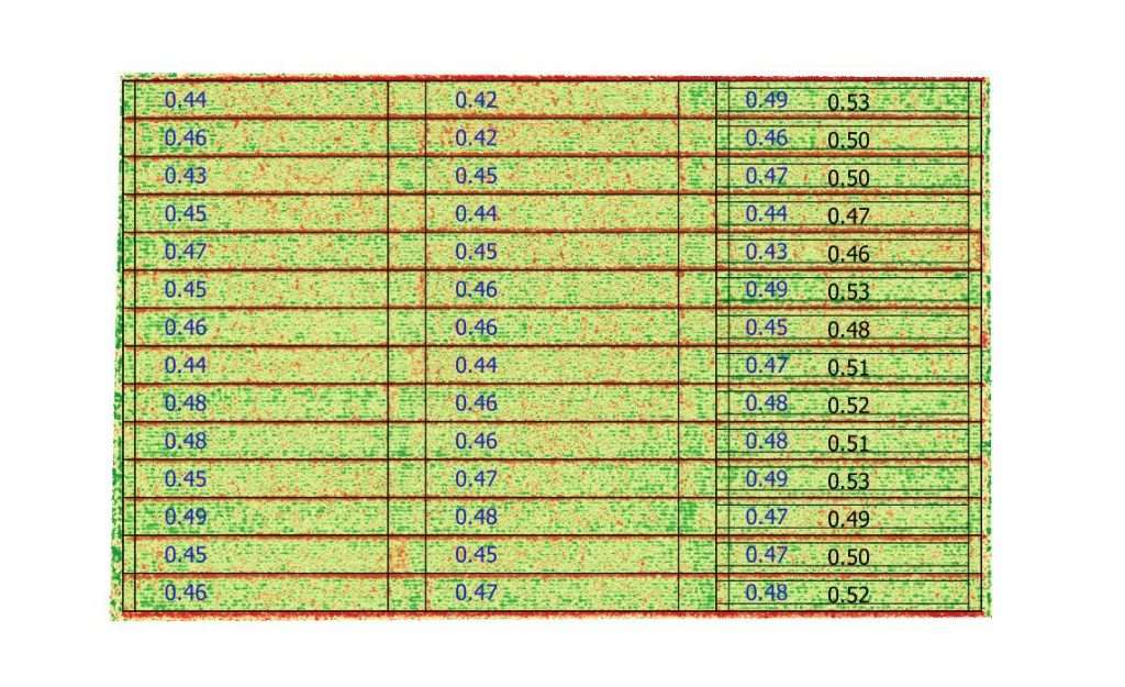
– Data processing (Pix4D – Photoscan …) to get orthomosaic per flight with a vector file of micro-plots allowing a vegetal indexes analysis (NDVI, VARI…) : mean per micro-plot and accurate estimation of plant stress (weeds, diseases, hydric and thermic : cold – heat) per micro-plot or counting.
– Micro-plot vectorization to undersize micro-plots and avoid “border” effect.
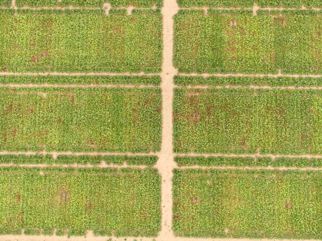
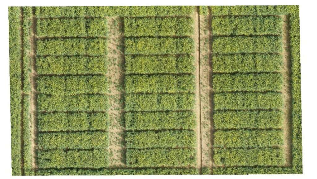
Agricultural fields and AgriVoltaism :
Flights can be done with a fixed wing UAV or a multi-rotor drone as well (RGB or Multi-spectral sensor) :
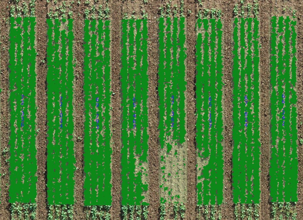
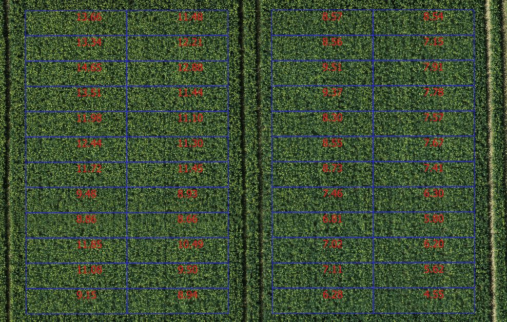
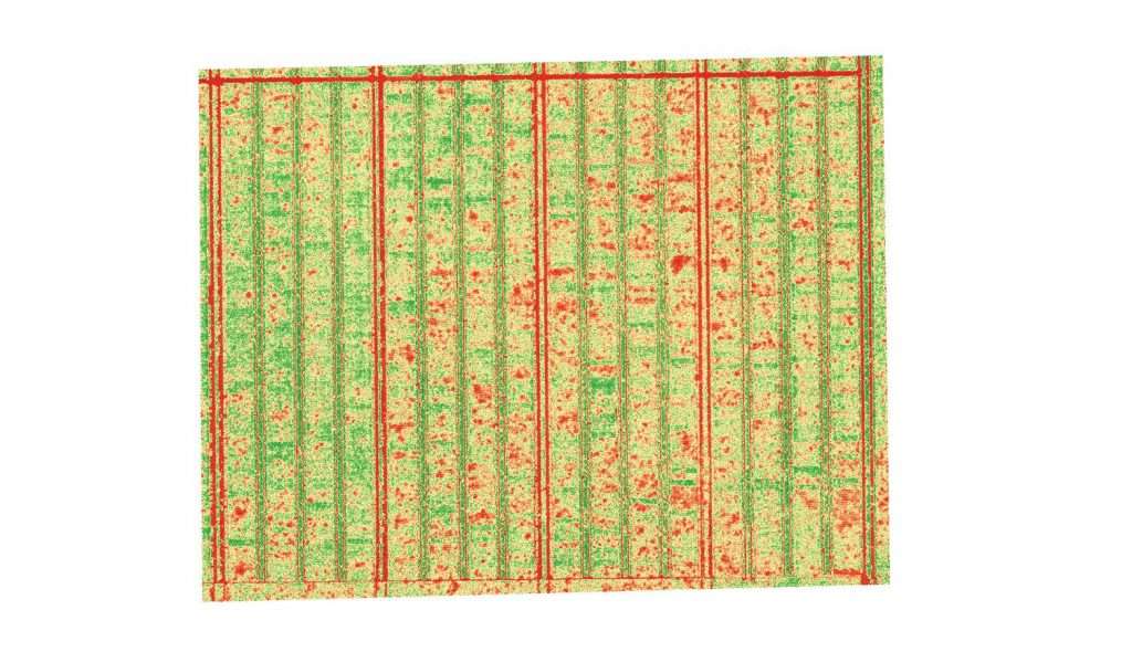
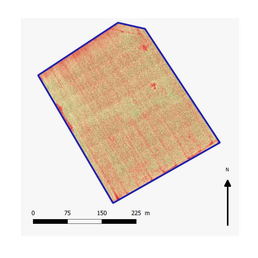
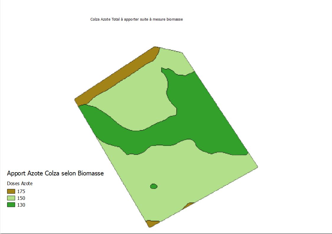
– Vegetal indexes (NDVI, NDVIE, EVI2, CCCI…) : release of a mapping of field, a vector file (shp) and a XLS sheet including spraying recommendations.
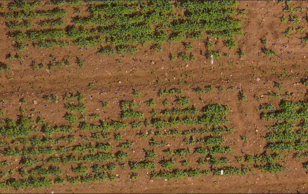
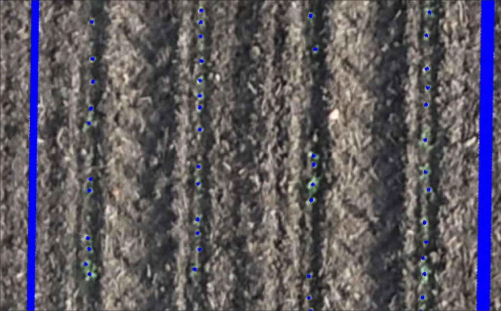
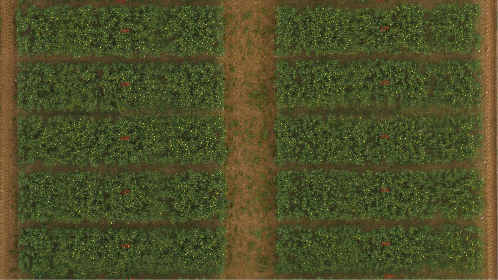
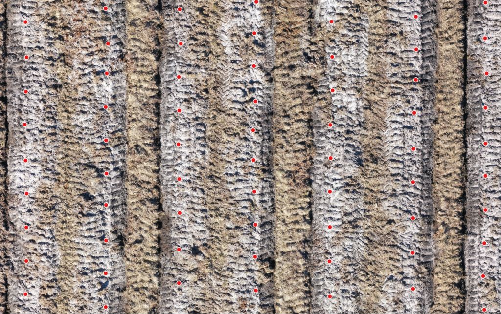
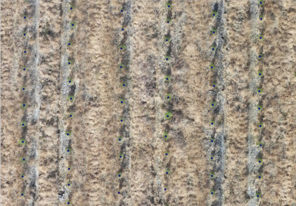
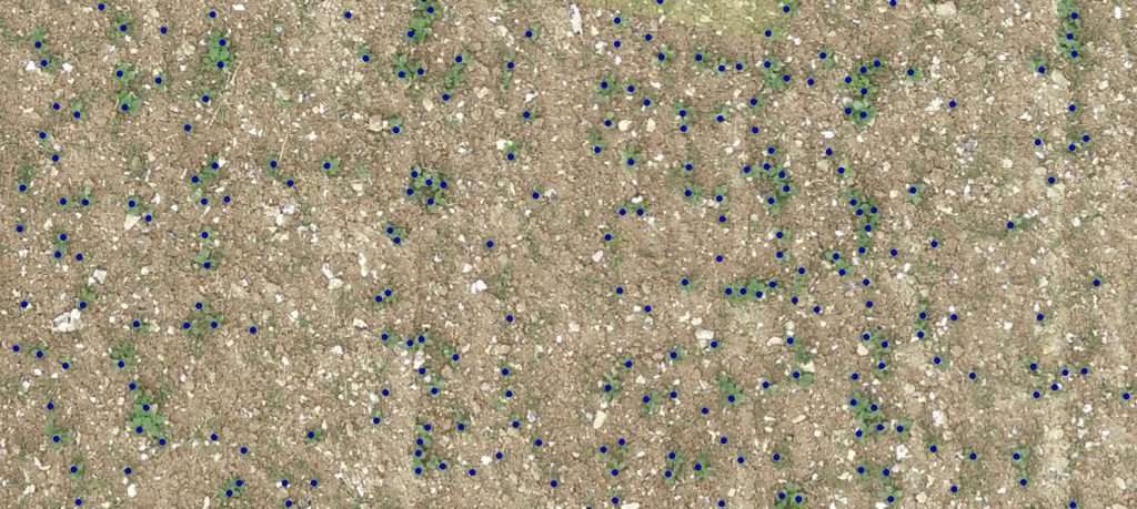
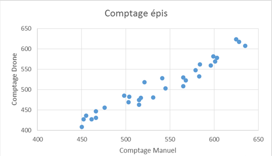
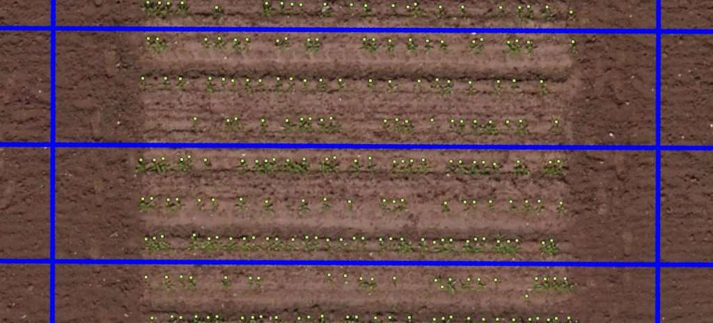
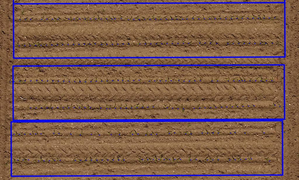
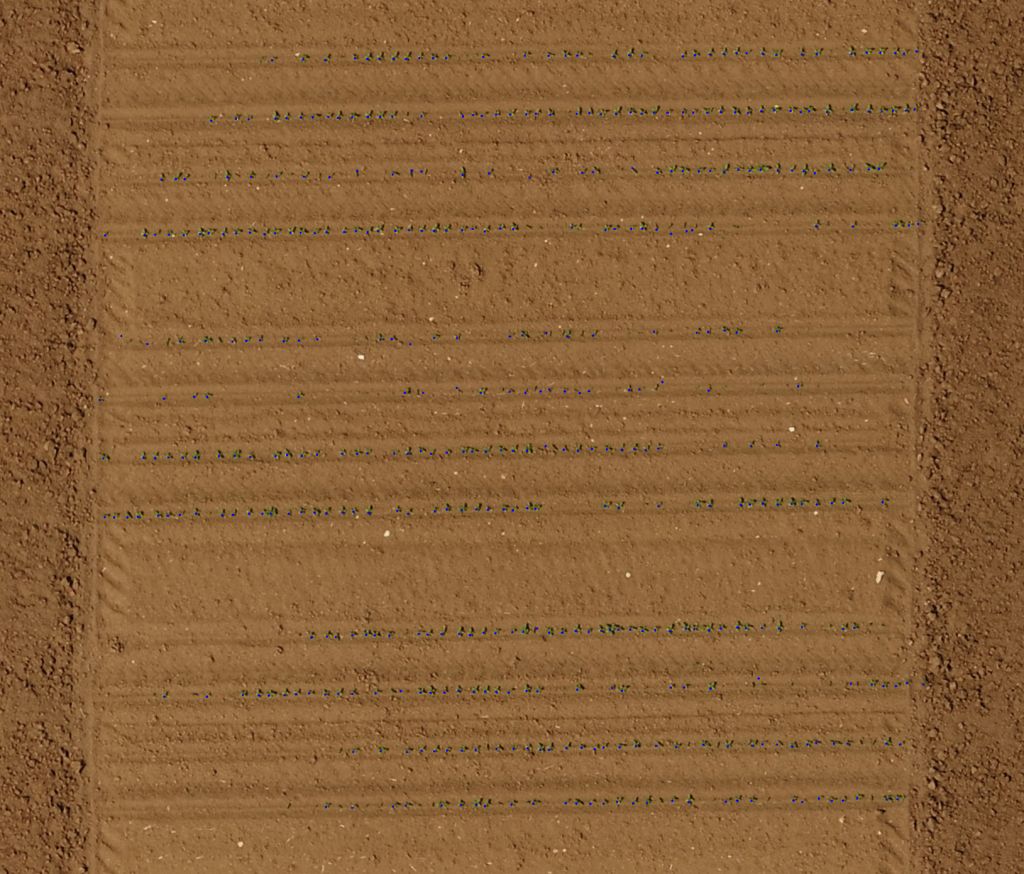
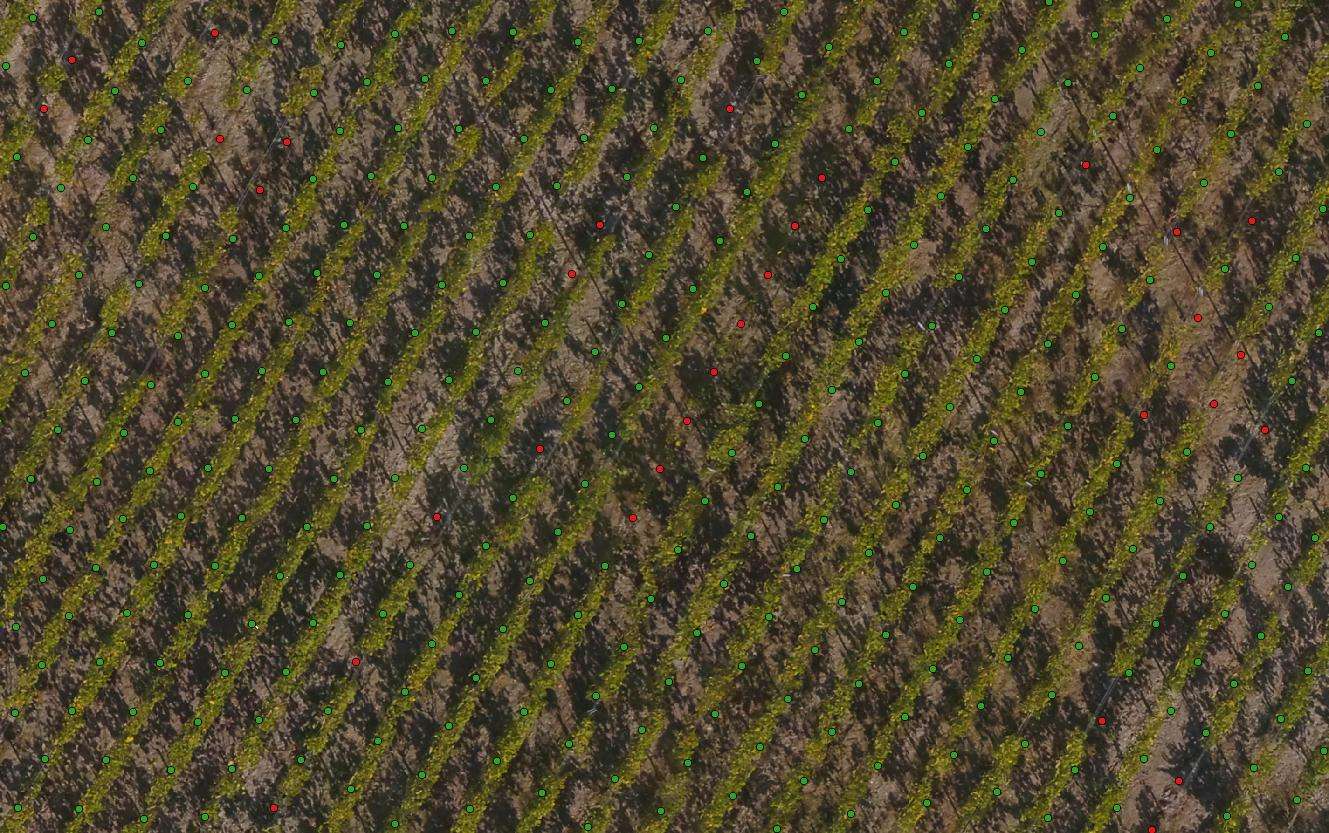
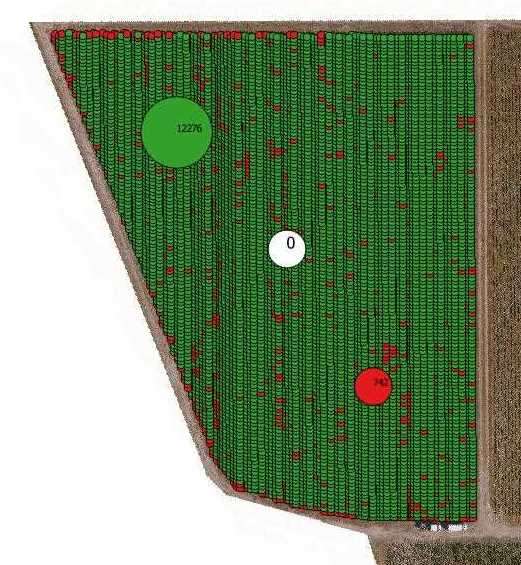
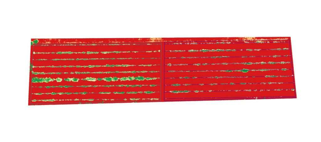
– Counting with missing on maize, sunflower, vineyards, orchards…
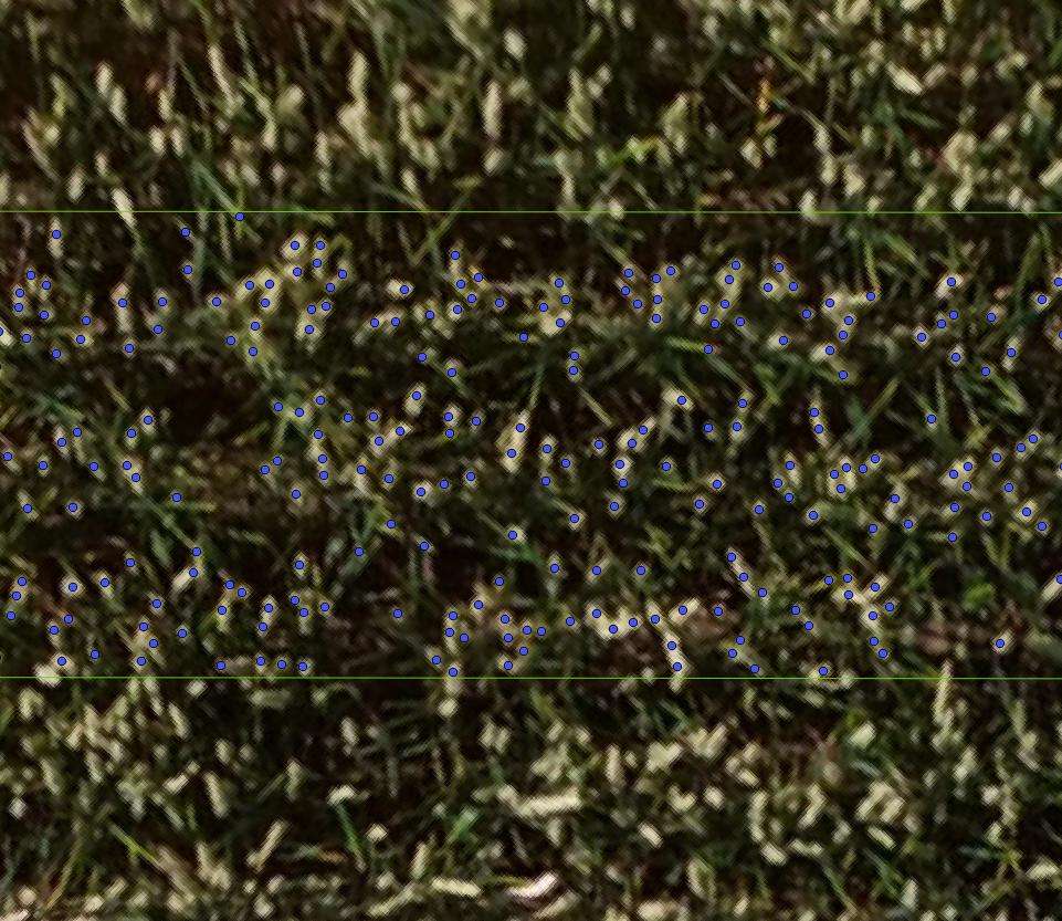
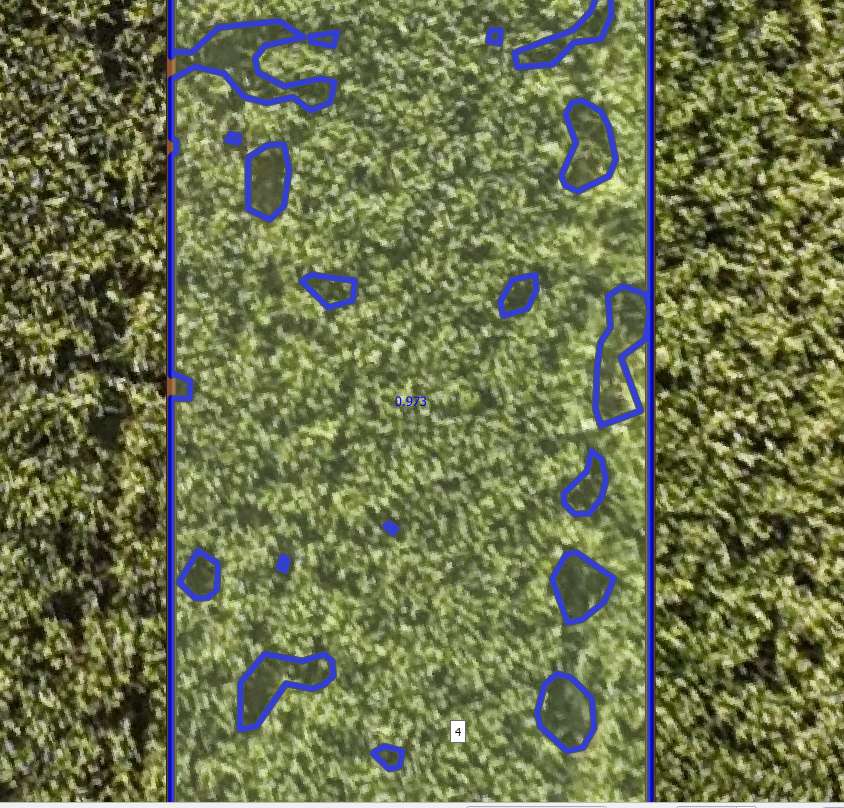
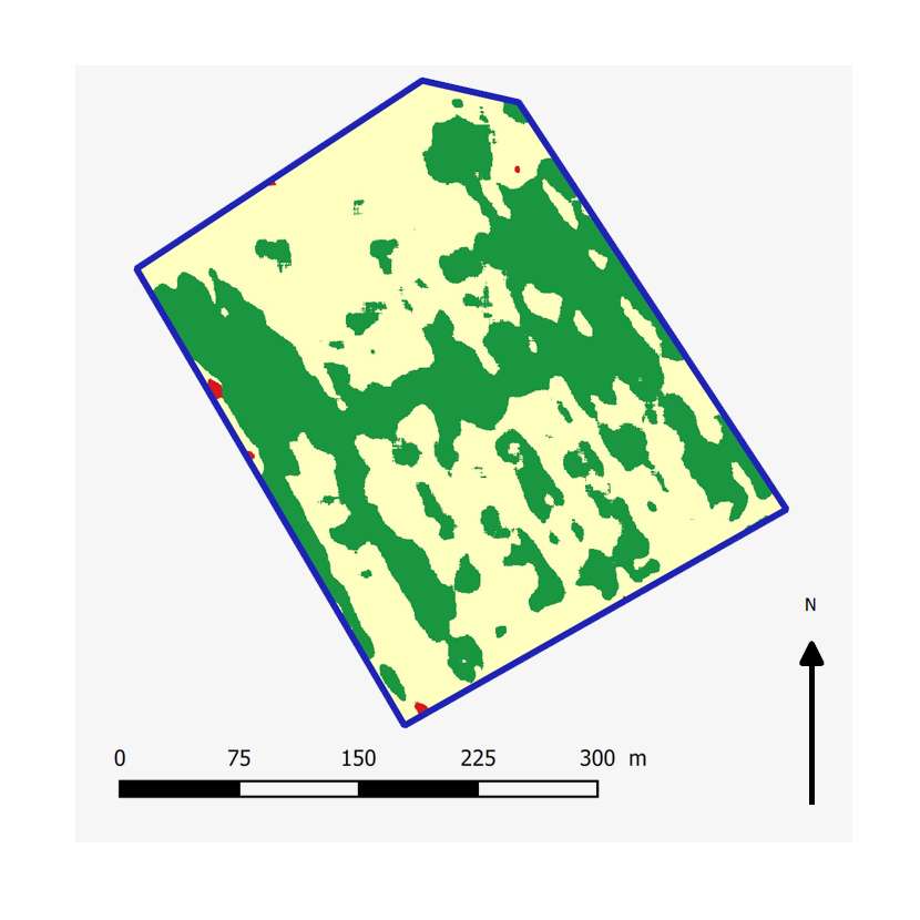
– Weeds zoning on root crops : release of a zoning map (plus shp file and XLS sheet).
– Wildfolw damages with same method
– Evaluation of Loss of Yield in scope of AgriVoltaism
Forests – Environment
Forests – Nurseries – Orchards :
Trees counting (forestry – nurseries) with missing or not.
Vegetal Indexes : chlorophyll detection, sick trees
Rows height
Canopy or isolated trees height
Environment :
Foreshore follow-up, seaweeds population evaluation, vegetal cover measurement of waste and industrial sites …
Others
Stones Pits Operations Samples.
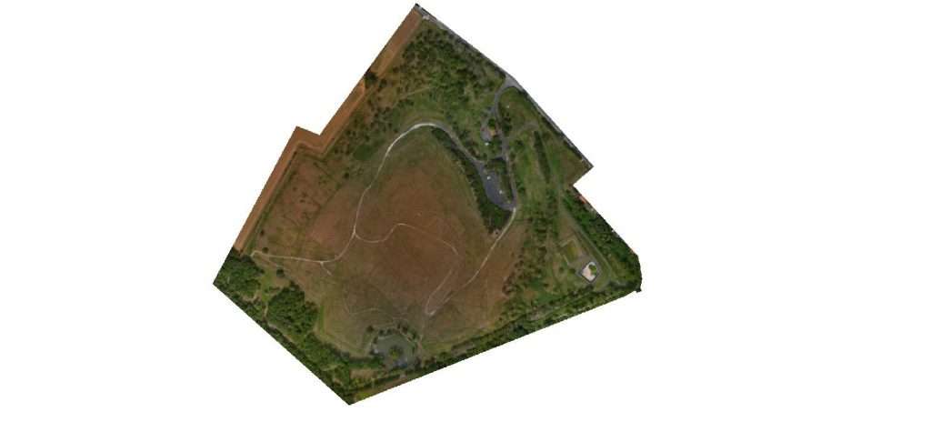
Orthomosaic release and DMS (Surface Data Model).